Oosterschelde, the largest national park in the Netherlands
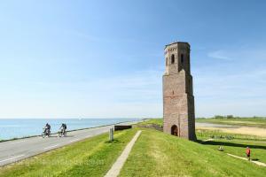
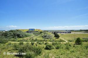
National Park Oosterschelde is, with more than 37,000 hectares, the largest national park in the Netherlands. It is located between the Zeeland islands of Schouwen-Duiveland, Tholen and Noord-Beveland.
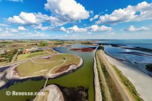
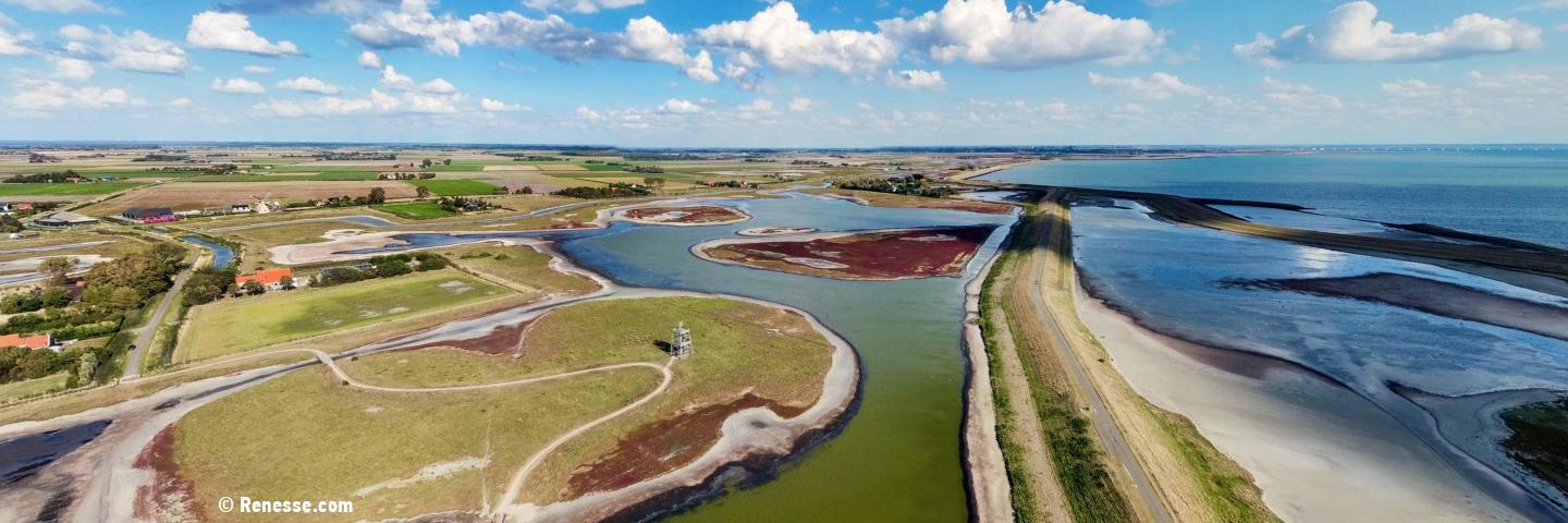
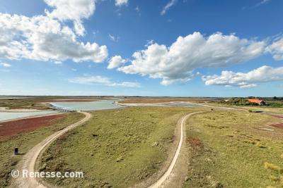
Tidal area: largely made up of water, mudflats, salt marshes, sandbanks and dykes. Tides create a constantly changing landscape every day.
Low tide: exposed sandbanks full of birds and resting seals.
High tide: a vast body of water that gives the area its unique dynamics.
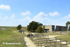
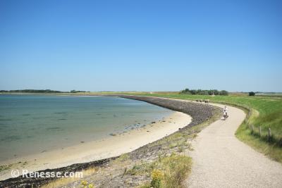
Activities: a paradise for walkers, cyclists, birdwatchers and those seeking peace and quiet. Popular with divers, sailors and nature lovers eager to explore the water.
What makes the Oosterschelde unique?
Former sea arm: once part of the North Sea, still openly connected to the sea despite the Delta Works.
Dynamic ecosystem: tides and currents keep the area vibrant and full of variety.
Biodiversity: more than 10,000 species of plants and animals.
Seals and porpoises: often visible from the dykes or during boat trips.
Diving paradise: internationally renowned for cuttlefish, lobsters and colourful underwater flora.
Birds: spoonbills, avocets, geese and countless migratory birds.
Peace and space: wide-open views and silence – without mass tourism.
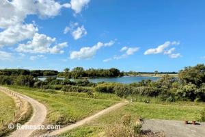
National Park Oosterschelde consists of various sub-areas, each with its own character. Below is an overview of the most important and beautiful places on Schouwen-Duiveland.
History: the only remaining structure of the drowned village of Koudekerke, symbol of the centuries-long battle against the water.
View: from the top, panoramic views across the Oosterschelde.
Seals and birds: you can often see seals resting on the sandbanks and countless birds feeding in the tidal area.
Practical information
Visit: the tower is freely accessible. Inside, you will find a small exhibition about the drowned village and the surrounding nature of the Oosterschelde.
Parking: directly next to the tower, along the Plompetorenweg, there is ample parking space.
Walking route: the 3.5-kilometre “Around Plompe Tower” route by Natuurmonumenten lets you explore the vast landscape.
Photo spot: a favourite among photographers thanks to the combination of cultural history and natural beauty.
Creek Area the Schelphoek
The Schelphoek is located near Serooskerke, on the southern side of the island.
Origin: created by a major dike breach during the North Sea Flood of 1953, which formed a deep inlet.
Nature reserve: now protected and managed by Staatsbosbeheer, with a mix of creeks, mudflats, salt marshes and woodland.
Bird area: an important breeding and resting place for waders, ducks and migratory birds; in winter often thousands of geese.
Peace and quiet: relatively unknown to tourists, allowing you to experience nature in tranquillity.
Heritage: together with Ouwerkerk and the Watersnoodmuseum, it forms a commemorative landscape of the 1953 disaster.
Practical information
Parking: Along the Serooskerkseweg there is a large car park right at the entrance to the nature reserve. You will also find an information point with several panels explaining the history and nature of the area.
Origin: large-scale nature development project launched in the 1990s to restore the declining bird population in Zeeland.
Surface area: over 4,400 hectares, consisting of former farmland converted into mudflats, pools and saline grasslands.
Landscape: a mix of wetlands, creeks, open water, reed beds and grasslands that change with the tides. Habitats for waders, geese and other water birds.
Education: information panels and excursions by nature organisations make the area interesting for families and schools.
Seasons: breeding ground for avocets and terns in summer; winter refuge for thousands of geese and ducks.
Practical information
Parking: from the car park at Flaauwershaven you have an excellent starting point to explore this bird-rich nature reserve.
Routes: explore the area via the various cycling and walking paths. Along the way you will find information panels and picnic spots along the dikes – be sure to bring binoculars.
Tip: during spring and autumn migration, Plan Tureluur is at its most spectacular. You may sometimes see thousands of birds feeding and flying overhead at the same time.
Origin: a 140-hectare nature reserve created after the dike breach during the North Sea Flood of 1953 and later transferred to Staatsbosbeheer.
Creek area: varied landscape of water, woodland and “inlagen”, perfect for walking and birdwatching.
Woodland: consisting of oak, poplar, ash, elm and beech. Breeding ground for songbirds such as chiffchaffs and willow warblers.
Salt plants: the presence of glasswort and sea aster gives the area its distinctive appearance.
Inlaag: located between the sea dike and the main creek along the Weg van de Buitenlandse Pers; an important site for coastal birds to breed and shelter at high tide.
Birdwatching: chances of spotting kingfishers, swans, woodpeckers, grebes and birds of prey. In winter, you may even see a peregrine falcon hunting at high speed.
Peaceful nature: a mix of history, tranquillity and biodiversity, ideal for a relaxing day outdoors. A wonderful destination for young and old to enjoy walking, experiencing nature and the combination of education and recreation.
Practical information
Parking: the spacious car park at the Watersnoodmuseum is an ideal starting point for a visit to the creek area.
Watersnoodmuseum: highly recommended in combination with a walk. This impressive museum is housed in the caissons used after the North Sea Flood to close the dikes.
Walking routes:Staatsbosbeheer has created two marked trails, both starting and ending at the car park of the Watersnoodmuseum.
Red route (8 km): the most popular route, leading you through the varied landscape of the creek area.
White route (4 km): a shorter walk around the Oostkreek, ideal for those with less time or seeking a quieter walk.
Origin: a striking island where engineering and nature come together, created in the 1970s and 1980s as a working island during the construction of the storm surge barrier.
Nature and beach: quiet beaches and dunes where you can walk, sunbathe and spot birds, away from the crowds.
Deltapark Neeltje Jans: theme park where you learn everything about water, engineering, the North Sea Flood and the power of the sea; including aquariums and seal shows.
Water sports and excursions: starting point for boat trips on the Oosterschelde, with chances of spotting seals and porpoises.
Education and experience: interactive exhibitions, films and scale models provide insight into the battle against the water.
Practical information
Parking: at the Topshuis there is a large car park on the Dijkgraaf A.M. Gelukweg.
Routes: from here several beautiful routes start through the island’s dunes. On the information board to the right of the Topshuis, you will find an overview of the different options.
National Park Oosterschelde is a place where nature, water and culture come together. From the bird-rich Prunje in Plan Tureluur to the impressive storm surge barrier on Neeltje Jans, from the tranquillity of the Schelphoek to the salty flavours of mussels – this is where you experience Zeeland at its purest.
Whether you are walking, cycling, sailing or simply enjoying the wide-open views, the Oosterschelde leaves an unforgettable impression. A place you should visit at least once in your lifetime!